
Back in May we spent 5 days at Swinton Fitzwilliam Primary School, carrying out a geophysical survey on their school field, which runs adjacent to the garden of 63 Toll Bar Road as shown below. Some of you may remember this garden as the location for a week long excavation last October, and where Andrew Allen originally unearthed a hoard of Roman greyware and Samian ware. Evidence of a Roman ditch was also uncovered, and the geophysics work we carried out in May was intended to discover whether there were any other features or associated ditches in the immediate area.

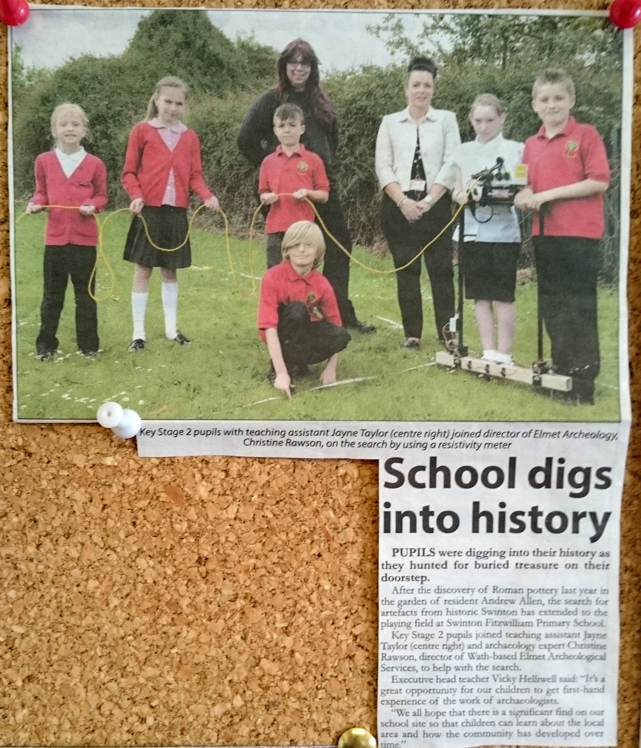
We completed the geophysical survey with the help of all of the juniors classes at the school, and some of the infants even came out to see what we were up to!

Classes were taught how to lay out a 20M by 20M square as part of a larger grid, and why we do this when we carry out a resistivity survey. These grids not only enable us to know where we are in the survey area, but can also give us our marker points for where we actually traverse the square to take readings.

Despite the inclement weather for the first three days, we were only forced to take shelter from the driving rain once; instead of completing the geophysical survey, the class that was with us learnt about life in the Roman world. The class already had extensive knowledge on the subject, and were able to tell us all about the kind of houses Romans might have lived in, and what life in the Roman army might have been like.


We made sure everyone got a go at all the different jobs, even the teachers, parents and grandparents!
Even the press were interested in what we were up to! A reporter from the Dearne Valley Weekender came out to have a look at our work, and talk to the school about the possible history underneath their field.
Later on in the week, we even had time to teach some of the classes how to do levels up and down the field using an auto set level and staff to take readings, and how they fit into the Ordnance Survey mapping system.

We have now completed analysing the results from the resistivity survey!
As you can see, we have (rather unexpectedly) found the schools old football pitch! The brightness of the pitch outline may be a result of compressed lime or chalk being used to mark the pitch, giving us these odd results and possibly masking some other features. The large blue square in the South East corner is where one of the classrooms was located, and the two smaller blue squares are the path up the hill.
However, in addition to this, there are also a number of other features that could be archaeologically significant.
In the North West corner, there are several areas of high resistance. This is very similar to some of the results that we got from the geophysics carried out on Andrew’s garden which produced various artefacts and evidence of areas of burning as well as burnt stone, and so would be worth investigating further!
If you look just to the South West of the central circle of the football pitch, you can see a large area of low resistance, which may be similar to the area of pot dumping in Andrew’s garden, especially as the low resistance abuts against the boundary between his garden and the school field.
Directly to the South of this area, there is another area of high resistance. This may be a demolished building, and we would love to investigate!

We are very pleased with the outcome of the work carried out at Swinton as part of Phase 2 of the Roman Swinton Project, and it really does highlight that extensive work is needed in the area to unveil the history of Swinton.
The school are already excited about the possibility off further work, and we would love to come back and do more!
